


SOLAS EIGE, SHINING THE LIGHT OF EIGG
SOLAS EIGE, SHINING THE LIGHT OF EIGG
WHAT'S HAPPENING IN THE CHURCH
Our church has been used as a successful exhibition venue since 2022:
"Voices of the Eigg Community Buy-out",
"The story of Eigg in 27 objects",
"Postcards from Eigg",
and this year, "Eigg, a very special Landscape".
It is also a great venue for classical music and singing workshops.


Eigg a very special landscape
The exhibition for the summer season 2025 focused on the Eigg's crofting landscape and how it has changed over the centuries
What is crofting?
The term, ‘croft’ - croit in Gaelic - is the name given to a specific type ofsmallholding created by landowners on their Highland estates from the end of the 18th century. By that time, the traditional stocking of the landwith tenants who could be called upon to defend the clan territory was giving way to a monetary economy, when land rents subsidized the landlords’ way of
life.On Eigg, some of these tenants were large farmers,called tacksmen, occupying the large farms or tacks of Laig and Kildonnan, but
many were small farmers occupying smaller communal farms in as joint tenants, as in Cleadale. The Cleadale tenants were the first people of Eigg to be evicted from their land. A new township was set up under the cliffs, and crofts made out of the farm. The crofters were then expected to harvest valuable seaweed (kelp) to pay their rent. when the value of kelp went down, they too were threatened with eviction.Protection from eviction only came in 1886, following a decade of crofters' agitation, when an Act of Parliament finally granted security of tenure.
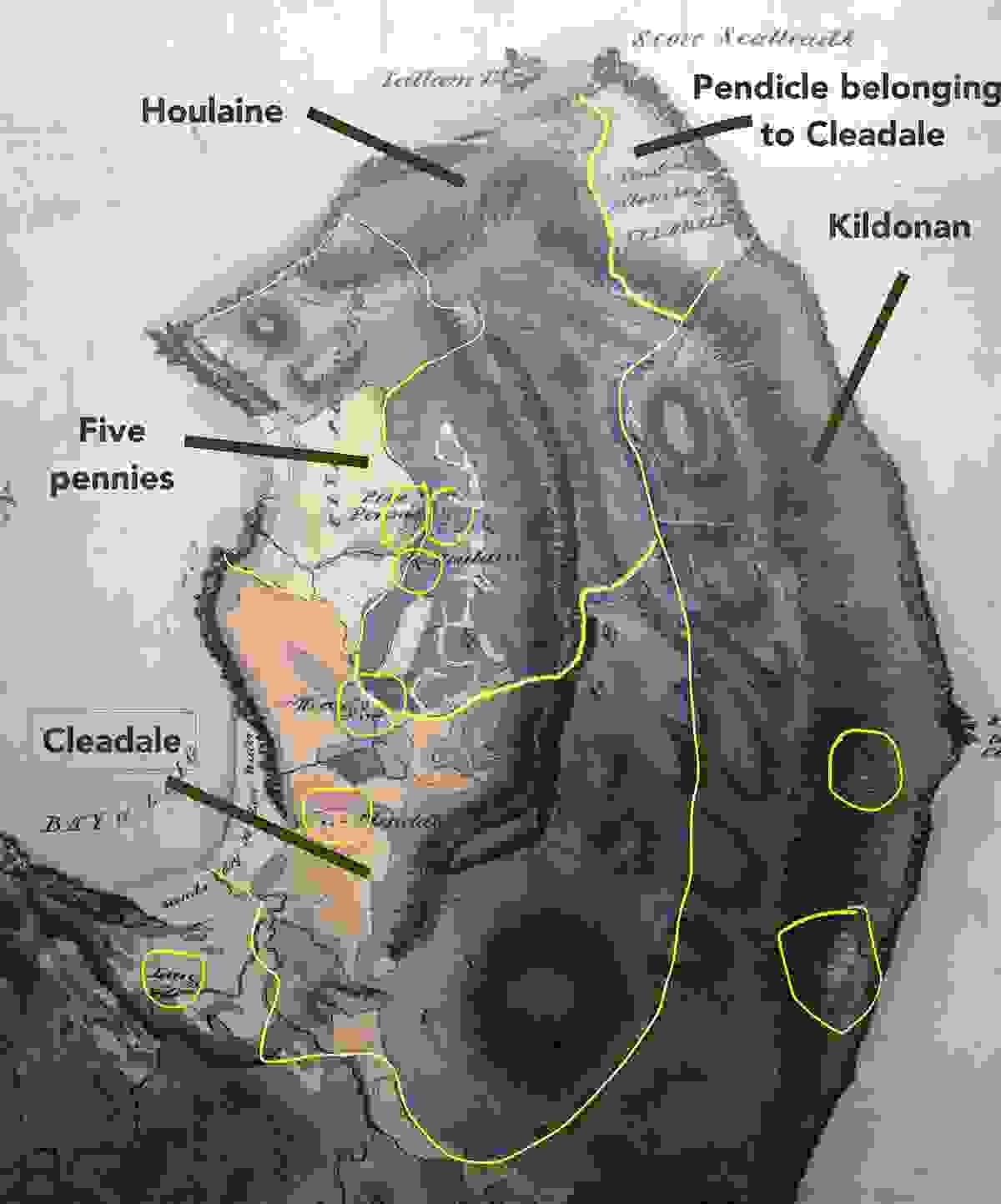
The island in 1806 just before crofting was introduced
This 1805 map by William Bald shows some of the island farms: part of Laig, Cleadale, 5 pennies, Houlaine and part of Kildonnan farm. It also shows the townships - the villages where people lived - along side cultivated areas and shielings or summer pastures. It also gives an idea of the island topography and is one of the first modern maps in Scotland.
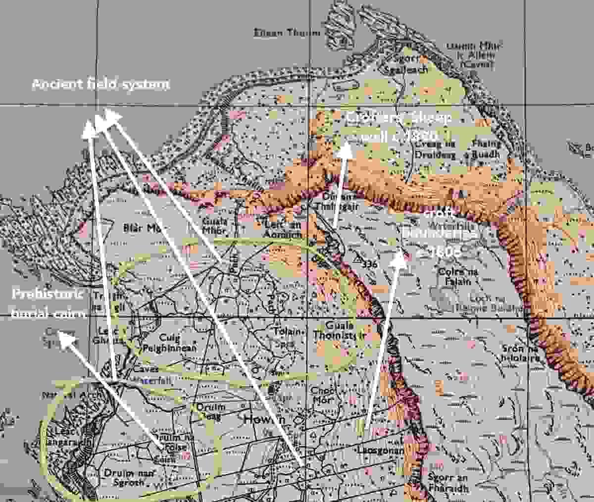
How to read the landscape features
The 2000 survey of the island by the Royal Commission on Ancient and Historic monuments (RCAHMS) brought to light the richness of the Eigg landscape:
- a mosaic of pasture and arable fields with traditional boundary features such as earthen
dykes and drystone dykes - Evidence of ancient settlements from neolithic through Bronze Age and Iron Age: hut circles, burial mounds, duns, forts
- Evidence of medieval farming, rig and furrows and lazybeds cultivation along with townships and ancient field systems underlying the crofts.
- a mosaic of pasture and arable fields with traditional boundary features such as earthen


